The view in this picture looks across Kilchoan Bay, with the village strung out around it, towards the mouth of Loch Sunart and the hills of Morvern.
The hill at the northeast end of the ridge is called Tom na Moine. As we rounded it and began to climb towards the twin lochans, it stopped raining and a patch of brilliant sunshine drifted across Estate land.
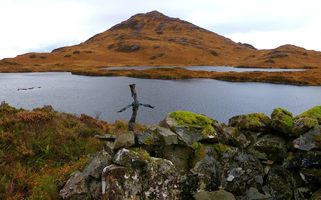
On the saddle at the east end of the bowl of land which the twin lochans occupy is this lonely steel post. It stands on the boundary between the common grazings of the crofting townships of Ormsaigbeg and Ormsaigmore. Its vertical is set into the bedrock: it would be interesting to know how the hole was drilled.
As the steep cliff which forms the north face of Druim na Gearr Leacainn came into view three red deer hinds broke cover and ran away from us, disturbing a small flock of sheep. This is the closest we've seen deer to the Ormsaigbeg croft lands: much closer, and they'll be visiting our vegetable gardens at night.
Below the cliff is this semi-circular cairn which commemorates the place where, in February 1944, Flight Lieutenant Arthur Woodgate's hurricane fighter flew into the hill, killing him. It's a dark, lonely spot, looking out across the lochans to Ben na Seilg.
A little further on there's a point where the cliff falls back and it's possible to scramble up to the ridge line. By this time the wind had risen, bouncing over the hill and coming down vertically onto the lochans, forming catspaws which chased each other across the water.
As we came onto the south side of the ridge and looked across the Sound of Mull, searchlights of sunlight were moving across the sea. Only one ship moved, the Tobermory-Kilchoan ferry, the Raasay, a speck in the immensity of sea and sky.
A map of the area is here.


There are a large number of these old iron posts drilled into boulders and bedrock across the region. The drilling of the holes and leading in of the uprights must have been skilled work. I was told decades ago, by an old shepherd on Morvern, the job required two men. One to hold a broad bladed drill, and twist it a slight bit, between blows from a heavy hammer wielded by his partner. From time to time they would swop roles. ...and then came the melting of the lead... for which in later days a pressure parafin blowtorch was used.
ReplyDeleteI stand to be corrected of course.
Many thanks for your reply. It would very very interesting, and useful, to know when this sort of fencing was done. This sort of fence, and the labour to erect it, must have been costly, so presumably only important fences were done in this way.
ReplyDeleteGiven that the lifespan of the wire was probably no more than 30 years. The old shepherd ( who had survived the Battle of Loos and several years in the trenches of the first world war -in his kilt !) remembered it being done when he was young. This would suggest they were still being erected between 1890 and say 1940. ( Wartime shortages of iron would have ended it ?) I can still remember seeing the remains of rusted wires in many of posts on Morvern into the 1960's. Today the economics of it all serve to remind us of a time when very different priorities existed within the west highland economy.
ReplyDelete